Camino de Santiago Map: Every Route To Santiago de Compostela
A Camino de Santiago map is really a map of converging routes, all of them funneling into one cathedral city in Galicia. This guide explains what the map shows, which routes matter, and how to read it before walking.
Short answer
A Camino de Santiago map shows the recognized pilgrim routes converging on the Cathedral of Santiago de Compostela, with the Camino Frances the longest-established path. The last 100km on foot (200km by bike) is the certified minimum, and the Holy Door opens for the 2027 Holy Year.
The Camino de Santiago is not one path but a web of them, and every thread of that web ends in the same place: the Cathedral of Santiago de Compostela in Galicia, northwestern Spain. A good Camino de Santiago map is the single most useful planning document a pilgrim can hold, because it answers the three questions that decide everything else: where you start, how the route bends across the country, and where the shell markers finally stop. The Oficina del Peregrino's own FAQs define what makes a route count: the last 100km walked, or the last 200km cycled, on a recognized Camino, with at least two stamps per day in the credencial. Everything on the map exists to feed walkers toward that certificate at Rua das Carretas 33.
This guide from the Santiago de Compostela Travel Guide editors walks through the map layer by layer: the routes, the distances that matter for certification, the terrain, and the final approach into the city. For the wider background, start with the companion page on the Camino de Santiago itself.
What Does A Camino de Santiago Map Actually Show?
A Camino de Santiago map shows the network of recognized pilgrim routes converging on the Cathedral of Santiago de Compostela, marked with the yellow arrows and scallop shells that guide walkers on the ground. It shows route names, stage towns, albergue stops, and the final 100km or 200km thresholds that determine whether a walker or cyclist qualifies for the Compostela certificate. It is a map of a destination, not a single trail.
The mental shift most first-time pilgrims need is this: the Camino is a radial system. Think of the cathedral as the center of a wheel and the routes as spokes arriving from France, Portugal, the Atlantic coast, and inland Spain. The shell symbol you see set into walls and pavements across Galicia is the same symbol on the map, and the yellow arrow painted on fence posts and kerbs is the same arrow that map publishers draw as a route line.
A useful map carries three layers. The first is the route line itself, the sequence of towns and villages the route passes through. The second is the service layer: where beds, food shops, and stamping points sit, which is what the pilgrim passport and its stamps interact with daily. The third is the terrain layer, the elevation profile that tells you whether tomorrow is a ridge crossing or a river-valley stroll. Cheap maps show only the first layer, and pilgrims who plan from them get surprised.
The official recognition question matters too. The Oficina del Peregrino, which issues the Compostela from Rua das Carretas 33, recognizes a set of established routes, and the map is essentially a picture of that recognized set. Walk any recognized route's final 100km on foot with two stamps a day, and the map's job is done: you arrive in Santiago de Compostela eligible for the certificate.
Which Camino Routes Appear On The Map Of Routes To Santiago de Compostela?
The map shows six principal routes: the Camino Frances from the French border, the Camino Portugues from Portugal, the Camino del Norte along the Atlantic coast, the Camino Primitivo from Oviedo, the Camino Ingles from the Galician coast, and the Camino Finisterre, the one route that leads away from Santiago de Compostela toward the sea. Each has its own character, terrain, and stamping infrastructure.
The table below summarizes the routes without inventing distances, because the certified figures that matter are the 100km walking and 200km cycling minimums, not the full length of each path.
| Route | Direction Of Travel | Character | Best Suited To |
|---|---|---|---|
| Camino Frances | East to west across northern Spain | The classic, busiest route, well-serviced | First-time pilgrims wanting company and infrastructure |
| Camino Portugues | North from Portugal | Coastal and inland variants, gentler terrain | Walkers coming from Lisbon or Porto |
| Camino del Norte | Along the Atlantic coast | Green, hilly, quieter than the Frances | Pilgrims who want coast over crowds |
| Camino Primitivo | From Oviedo through the Asturian mountains | The oldest route, rugged and remote | Experienced walkers |
| Camino Ingles | Short, from the Galician coast | Compact, ferry-linked | Walkers short on time |
| Camino Finisterre | Westward from Santiago de Compostela | The only route leaving the cathedral | Pilgrims extending the journey to the sea |
Two of these routes hold UNESCO recognition in their own right: the Routes of Santiago de Compostela, the Camino Frances and the Northern routes, were inscribed in 1993, a separate listing from the Old Town of Santiago de Compostela itself, which was inscribed in 1985. The map, in other words, is partly a UNESCO document, and the history of the Camino explains how those routes became the recognized set.
Choosing between them is easier with the right background reading. The site's route-by-route comparison goes deeper on all the Camino routes, and for the classic path specifically, the Camino Frances guide covers staging in detail.
How Far Do You Need To Walk According To The Map?
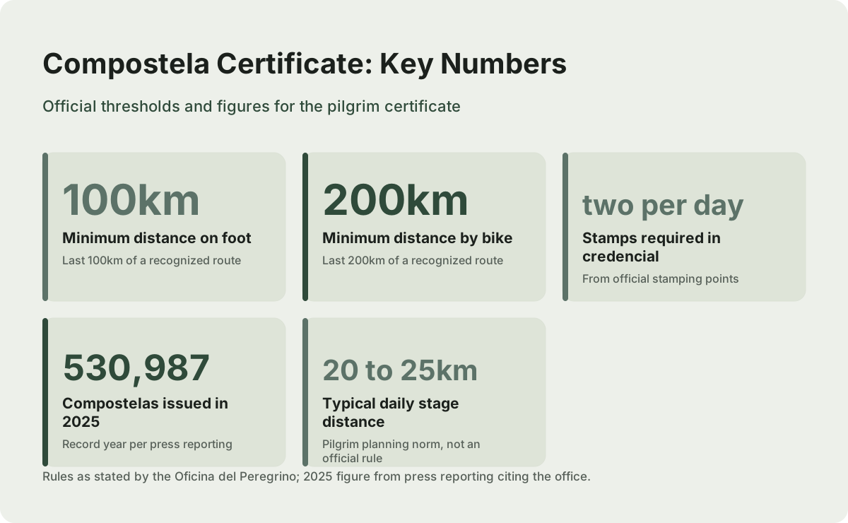
The certified minimum is the last 100km on foot, or the last 200km by bicycle, on a single recognized route, walked or ridden continuously, with at least two stamps per day in your credencial from official stamping points. The Compostela certificate is issued in person only, at the Pilgrim's Office at Rua das Carretas 33 in Santiago de Compostela. No other distance on the map carries an official threshold.
This is the single most important number on any Camino de Santiago map, and it is why towns like Sarria appear so prominently on planning maps: Sarria sits roughly at the 100km mark on the Camino Frances, which is why the Sarria to Santiago stage is the most walked final stretch in the entire network. The rule set is summarized below exactly as the Oficina del Peregrino states it.
| Requirement | Rule | Applies To |
|---|---|---|
| Minimum distance on foot | Last 100km of a recognized route | Walkers and horseback riders |
| Minimum distance by bike | Last 200km of a recognized route | Cyclists |
| Stamps | Minimum two per day, from official stamping points | All pilgrims seeking the Compostela |
| Continuity | The distance must be covered continuously on one route | All pilgrims |
| Where issued | In person only, Pilgrim's Office, Rua das Carretas 33 | All pilgrims |
The 2025 figure gives a sense of scale: press reporting citing the Oficina del Peregrino counted 530,987 Compostelas issued in that record year. Every one of those pilgrims crossed the same threshold distance on the map, and the cost of walking the Camino page carries the practical planning that follows from it, alongside the site's answer on how long the full walk takes.
The credential itself is the map's companion document. Where the map tells you where you are, the credencial proves it, and the two travel together in every pilgrim's pocket.
How Do You Read Elevation And Stage Planning On The Map?
Elevation on a Camino map reads as a profile line running under the route: flat stretches show as level line, mountain crossings as sharp peaks, and the profile's vertical scale, usually in meters, tells you whether a stage is a gentle valley walk or a sustained climb. Stage distances are printed between towns, and pilgrims typically plan days of roughly 20 to 25km, though the map itself carries no official daily rule.
The classic mistake is reading only the horizontal distance and ignoring the profile. A 20km stage that crosses a ridge can take hours longer than a 28km stage that follows a river, and the map's elevation layer is what reveals the difference. On the Camino Primitivo, for instance, the mountain sections are the defining feature; on the Portugués coastal variant, the terrain is gentler and the weather, rather than the gradient, shapes the day.
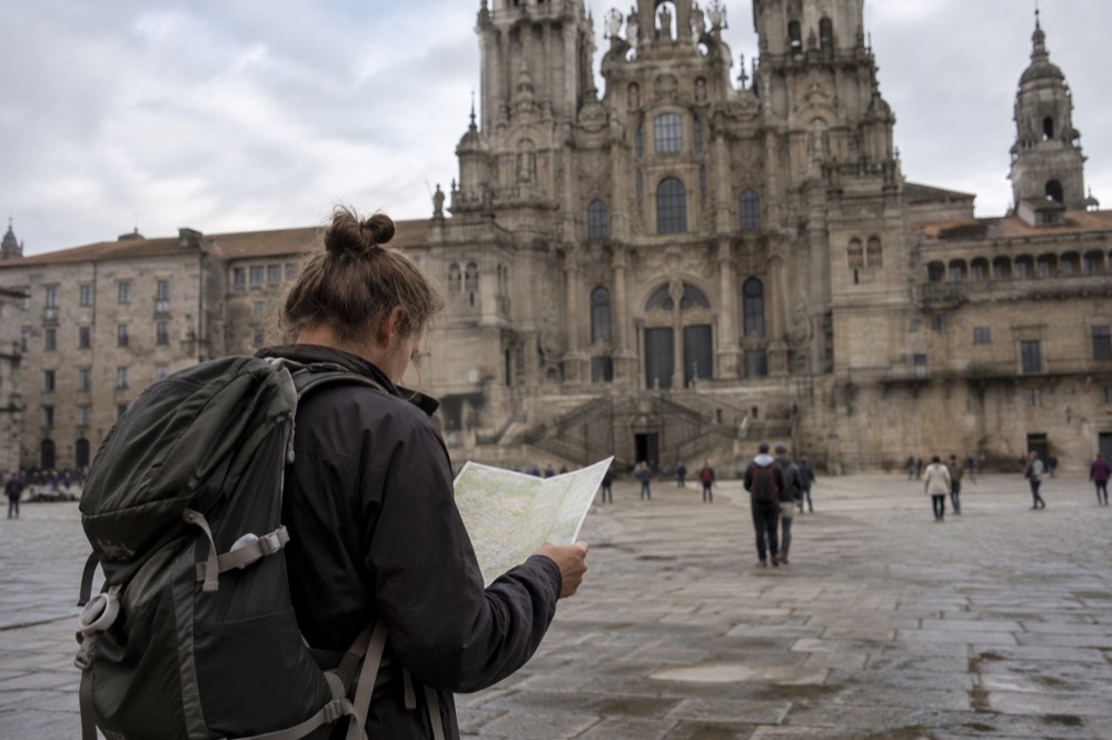
Stage planning also interacts with where you sleep. The albergue network maps onto the route line, and the two together, route plus beds, are what turn a line on paper into a walkable plan. Municipal albergues cluster in the stage towns printed on the map, which is why those towns, not the empty kilometers between them, define a pilgrim's day.
A note on weather, because the map's terrain and the climate are the same story. AEMET's climate data for the Santiago de Compostela station shows a temperate oceanic pattern: wet year-round, wetter from October to March, driest in July and August, with annual precipitation on the order of 1,690 to 1,890mm. The green on the map is earned by rain, and the best month to walk question is really a rainfall-map question.
Which Route Should A First-Time Pilgrim Pick From The Map?
Most first-time pilgrims pick the Camino Frances, because it is the best-serviced, most social route on the map, with the densest network of albergues, stamping points, and fellow walkers. The last 100km from Sarria is the classic certification stretch. The Portugués is the usual second choice, gentler in terrain, while the Norte and Primitivo suit walkers who prioritize quiet and coast over infrastructure.
The decision is really about what kind of walk you want. The Frances offers company at every stage and a well-worn rhythm; the Norte trades some of that convenience for Atlantic views; the Primitivo is the most demanding and the most ancient. The site's beginner-friendly Camino comparison works through the trade-offs, and there are specialist answers on the site for cycling the Camino, for older walkers, for women walking alone, and for doing it with kids.
The map also answers the start-point question before you ever book a flight. Pilgrims arriving from Madrid usually connect onward toward their starting town, and the site's pages on reaching the Camino from Madrid and on the best airport to fly into cover the logistics. The packing side is mapped out too, in the Camino packing list.
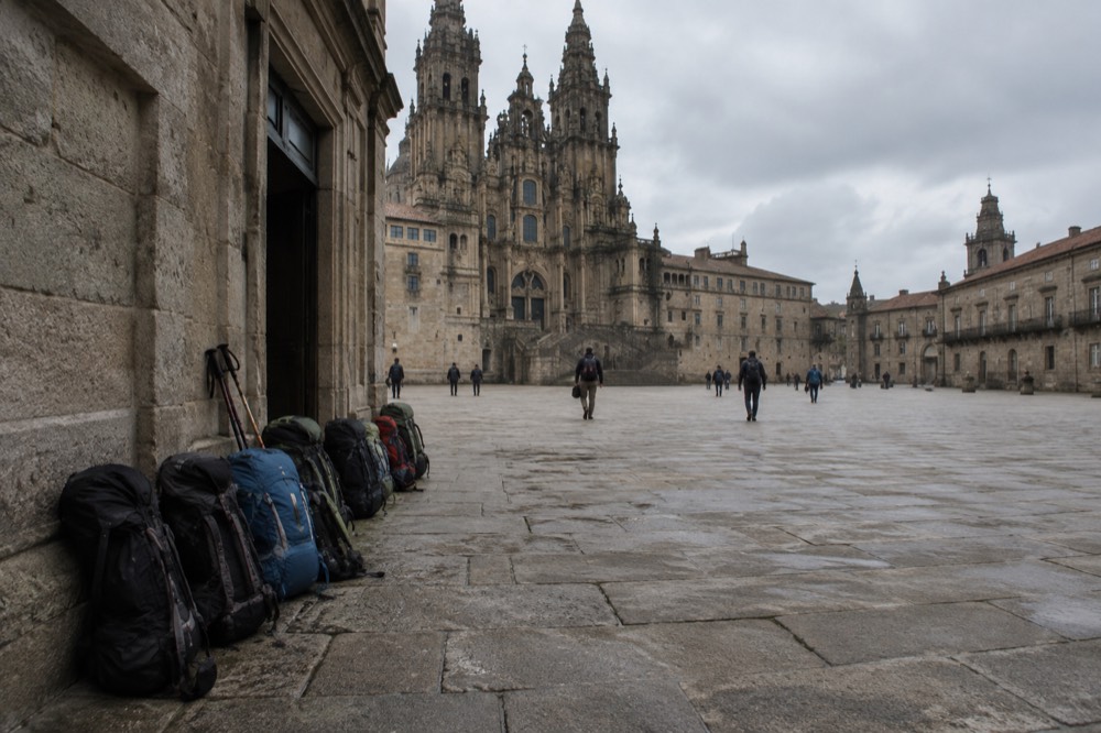
Where Does The Map End In Santiago de Compostela?
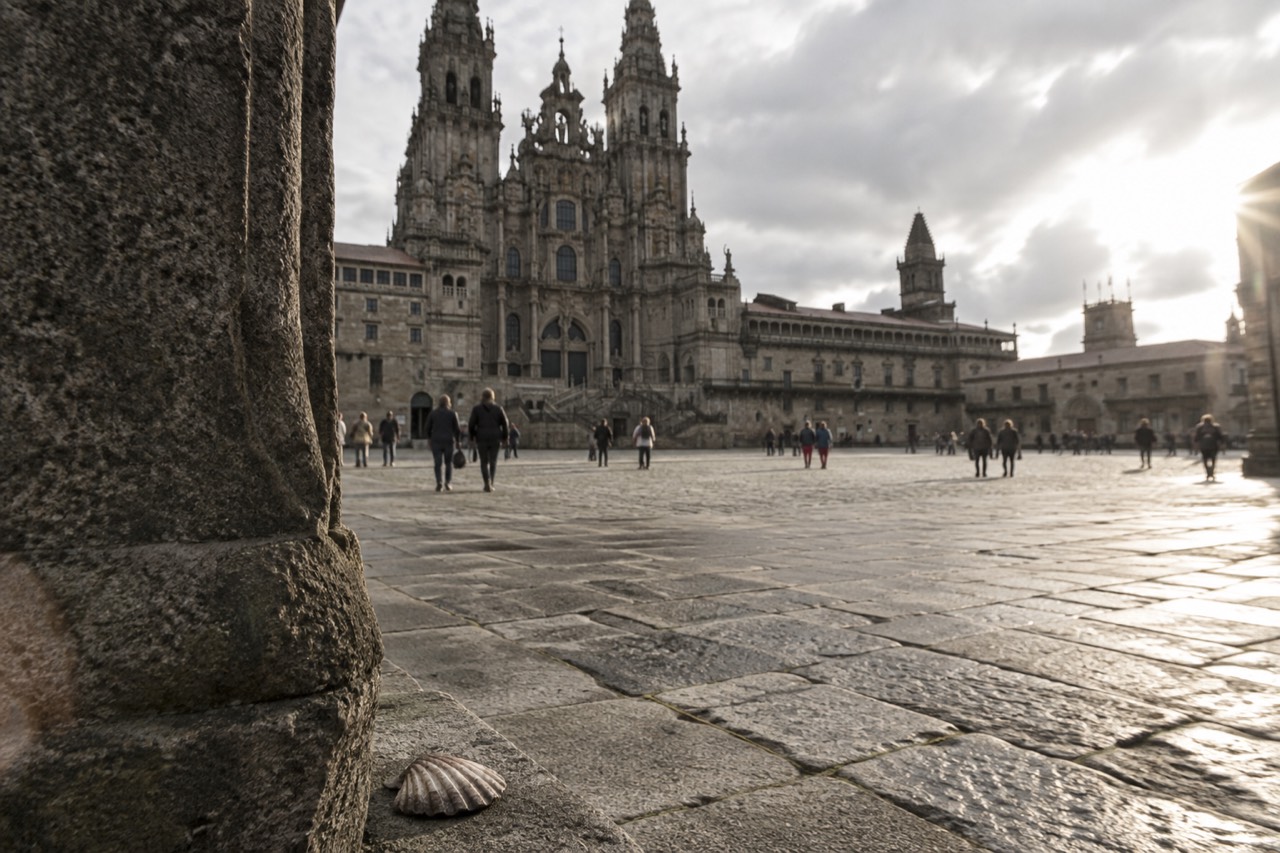
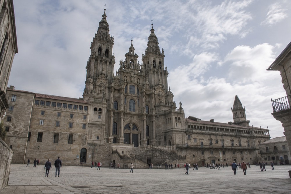
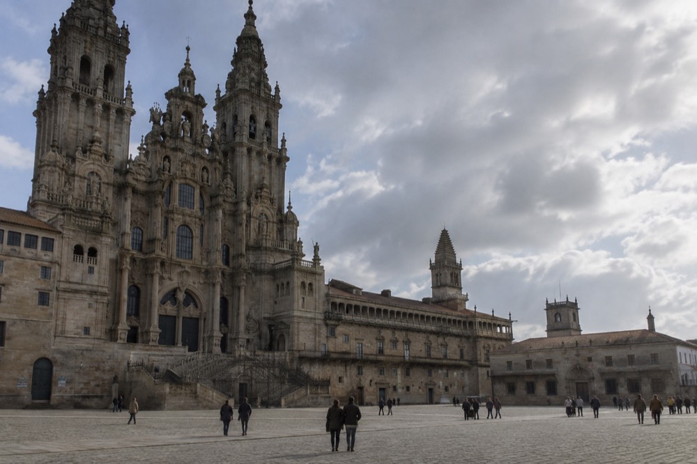
Every route line on the map ends at the same point: the Cathedral of Santiago de Compostela on Praza do Obradoiro, where pilgrims present their stamped credencial at the tomb of St. James. The arrival sequence runs from Monte do Gozo, the hill with the first view of the city, down through the streets of the Old Town to the cathedral facade, and the Pilgrim's Office at Rua das Carretas 33 is the administrative finish line.
The last day on the map is short and dense. Pilgrims crest Monte do Gozo, see the cathedral towers for the first time, and then walk the final urban kilometers into the Old Town, a UNESCO World Heritage site since 1985, distinct from the separate 1993 inscription of the Camino routes themselves. The arriving in Santiago on the Camino guide walks through that last day hour by hour.
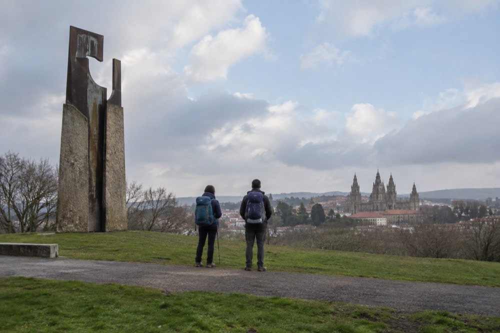
The city end of the map has its own logistics, and the pilgrim office guide covers the certificate collection in detail. Two current facts matter for anyone arriving in late 2026. First, the pilgrim masses at the Cathedral's High Altar, at 7:30am, 9:30am, noon, and 7:30pm, relocate from 16 October 2026: the 9:30am, noon, and 7:30pm masses move to the nearby Church of San Agustin, with only the 7:30am mass remaining in the Cathedral's Communion chapel. Second, the Botafumeiro, the giant censer that normally swings on twelve fixed solemnities a year, is currently out of action: scaffolding for the dome restoration covers its mechanism, the Cathedral confirmed this in writing on 5 September 2026, and no return date has been published. The pilgrim mass guide keeps both arrangements straight.
How Do You Get To Your Starting Point On The Map?
Most international pilgrims fly into Santiago de Compostela Airport, about 12km from the old town, or arrive by train: Santiago to Madrid runs roughly 3 to 4 hours on direct high-speed services, Santiago to Vigo about 1 hour, and there is no direct rail line to Porto, so travelers from Portugal change at Vigo. The airport bus, line 6A, currently costs 1 EUR paid to the driver or 0.36 EUR by card.
The arrival table below gathers the verified figures. One caution: the airport bus fare is in transition. As of late September 2026 the Tussa-operated line 6A still runs at 1 EUR to the driver, but a new Monbus contract with a higher fare, around 6 EUR, is expected in autumn 2026, possibly by December, so treat the fare as subject to change and check the live listing.
| Connection | Service | Typical Journey | Notes |
|---|---|---|---|
| Airport to old town | Bus line 6A (Tussa) | About 12km, a 20 to 30 minute drive | 1 EUR to driver, 0.36 EUR by card, fare subject to change |
| Santiago to Madrid | Direct high-speed train | Roughly 3 to 4 hours | Also covered in the train guide |
| Santiago to Vigo | Regional train | About 1 hour | Common connection for Portugal |
| Santiago to Porto | No direct rail | Change at Vigo | Regional Celta service to Vigo, then onward |
| Santiago to A Coruna | Direct regional service | A short hop | Useful for Norte route starts |
The airport guide expands the first row, and the site's train pages cover the Madrid and Porto approaches, including the Portuguese approach for Camino Portugues walkers.
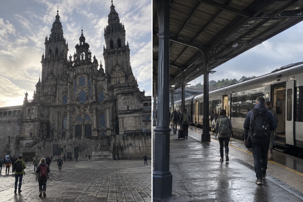
What Changes On The Map In The 2027 Holy Year?
The route lines do not move, but the crowds do: 2027 is the next Holy Year, the Xacobeo, because 25 July 2027 falls on a Sunday, and the Holy Door opens on the evening of 31 December 2026, staying open through 31 December 2027. Pilgrim numbers historically surge in Holy Years, so the map's quiet stages get busier and albergue beds in the final 100km book out earlier.
The Holy Door sits on Praza da Quintana, on the cathedral's east side, and walking through it during a Holy Year is one of the tradition's central acts. The Holy Year 2027 guide covers the calendar in full, and the Feast of St. James on 25 July page explains the fixed-date festival that anchors the whole system. After 2027, the subsequent regular Holy Years are listed as 2032, 2038, and 2049.
| Holy Year Milestone | Date |
|---|---|
| Holy Door opens | 31 December 2026 |
| Holy Year runs through | 31 December 2027 |
| Feast of St. James 2027 | 25 July 2027, a Sunday |
| Subsequent Holy Years | 2032, 2038, 2049 |
Planning a Holy Year walk means shifting every reservation earlier. The map's stage towns fill first at the Sarria end of the Frances, and the site's page on the new Camino rules tracks any requirement changes that accompany the surge.
What About The Map Beyond Santiago de Compostela?
One route on the map points away from the cathedral: the Camino Finisterre, which continues west from Santiago de Compostela toward Fisterra and Muxia on the Atlantic coast, the traditional end of the known world. The Cies Islands, off Vigo, extend the coastal picture further south. Both are day-trip or extension territory, reachable from the city by tour or public transport.
The Finisterre extension is the map's poetic footnote, and the Finisterre guide covers the coast, with Muxia at the road's other end. The site's answer on whether the walk from Santiago to Finisterre is worth it weighs walking it against riding it. For walkers who finish in the city and want to see the coast without adding days on foot, guided day trips cover the same shoreline.
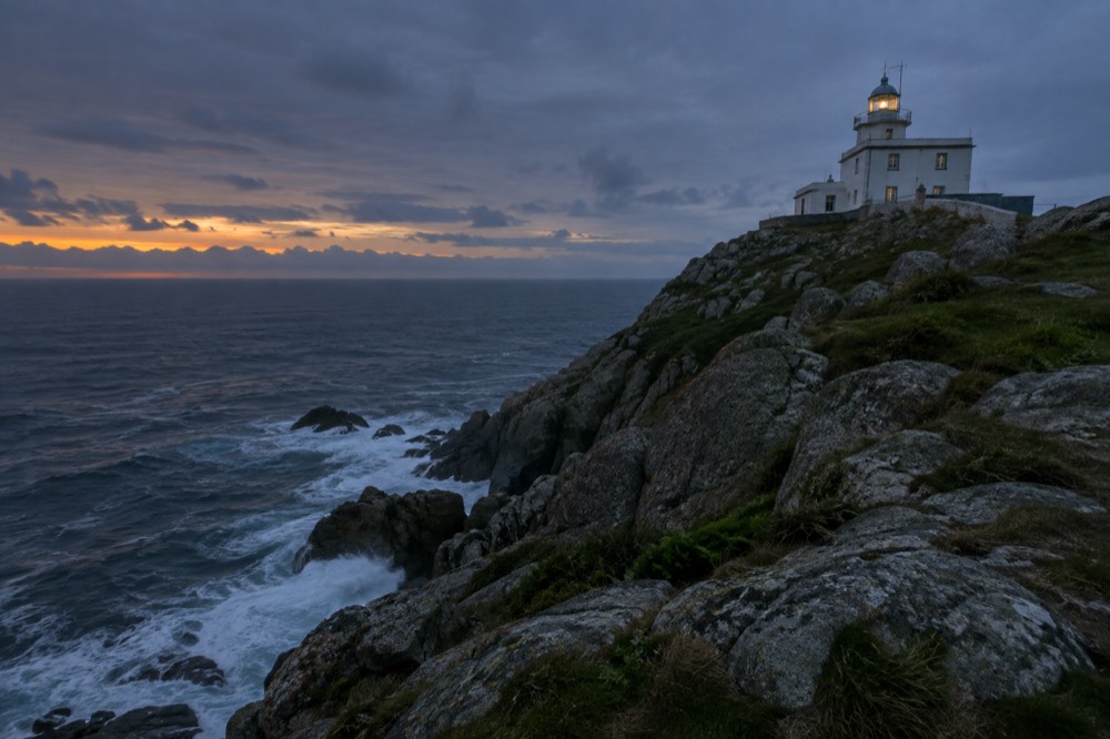
The Cies Islands sit at the southern edge of the same Atlantic world, part of the Rias Baixas system, and the Cies Islands guide explains the visit. South again, the Rias Baixas and Cambados wine country rounds out the coastal map for pilgrims with spare days after the walk.
Common Questions About The Camino de Santiago Map
What is the minimum distance on a Camino de Santiago map for the certificate?
The last 100km walked, or the last 200km cycled, on a recognized route, covered continuously with at least two stamps per day in the credencial. The Compostela is issued in person only at the Pilgrim's Office, Rua das Carretas 33, Santiago de Compostela.
Which route on the map is best for beginners?
The Camino Frances, particularly the final 100km from Sarria, because it has the densest infrastructure and the most company. The Camino Portugues is the common alternative for walkers wanting gentler terrain.
Does the map change in a Holy Year?
No, the routes stay the same, but the Holy Door opens: on 31 December 2026 for the 2027 Holy Year, which runs through 31 December 2027. Expect busier stages and earlier albergue booking in Holy Years.
How do I get to my starting point on the map?
Most pilgrims fly into Santiago de Compostela Airport, about 12km from the old town, or arrive by train: roughly 3 to 4 hours from Madrid, about 1 hour from Vigo, with no direct rail to Porto, so travelers from Portugal change at Vigo.
Can I see the Botafumeiro swing when I arrive?
Not currently. The Botafumeiro is out of action while dome-restoration scaffolding covers its mechanism, confirmed by the Cathedral in writing on 5 September 2026, with no return date published. It normally swings on twelve fixed solemnities a year, but no visitor should plan around seeing it until the Cathedral announces its return.
Does one route on the map lead away from Santiago de Compostela?
Yes, the Camino Finisterre, which continues west from the cathedral toward Fisterra and Muxia on the Atlantic coast. It is the only recognized route whose arrows point away from the tomb rather than toward it.
The map, in the end, is a promise: every line, whatever its starting point, arrives at the same cathedral door in Santiago de Compostela, and the walk between the paper and the Praza do Obradoiro is the part no map can draw.